
Deputy director of flood control claims China’s national plan for high-risk areas cannot meet targets.
By Yan Jie
During an exclusive interview with The Paper, Sixth Tone’s sister publication, an official in Wuhan exposed major financial deficiencies that put plans to reinforce floodplains along the Yangtze River at risk.
Shen Huazhong, deputy director of the flood control and drought relief office of the Changjiang Water Resources Commission, made the public plea for more resources after severe floods hit the Yangtze River Basin this summer.
From June 30 to July 3, rising floodwaters caused the deaths of 186 people during the worst flood season China has experienced since 2000. Another 45 went missing, and property damage amounted to more than 50 billion yuan (nearly $7.5 billion).
In 1999, the Ministry of Water Resources published an outline of a pilot construction project to ensure that 10 billion cubic meters of water — enough to fill 4 million Olympic-size swimming pools — could be safely absorbed.
Yet according to Shen, this construction site, situated near Chenglingji in central China’s Hunan province, where the Yangtze River is joined by Dongting Lake, remains in its early stages, with no completion date in sight due to inadequate investment.
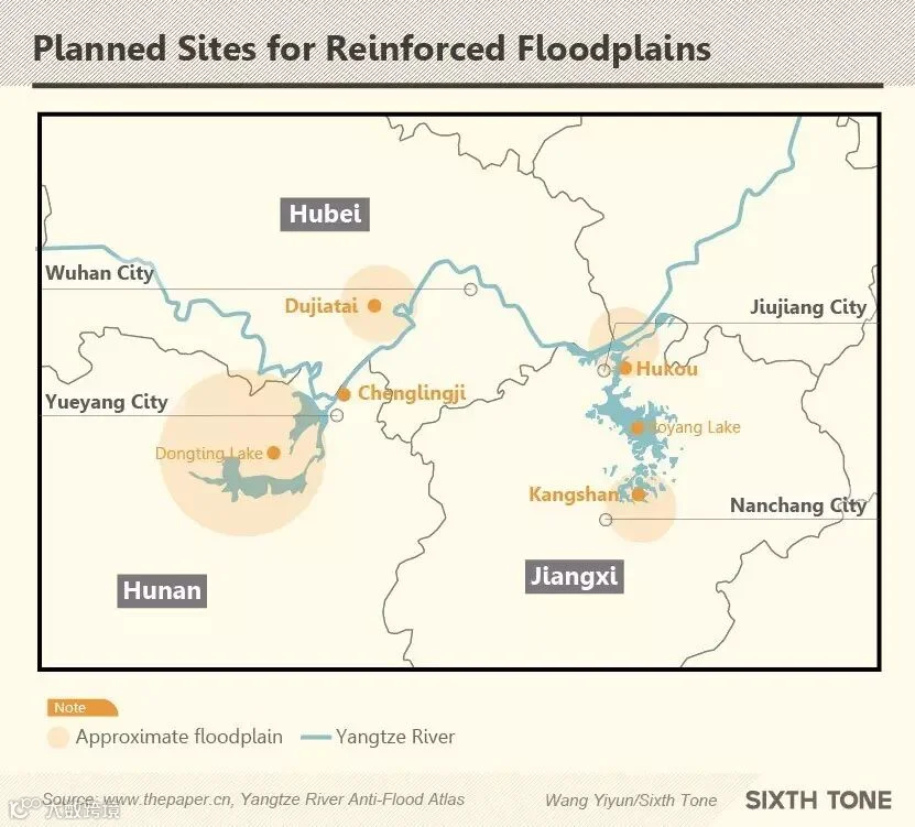
The pilot project also included plans to build reinforced floodplains in Dujiatai and Kangshan in the middle reaches of the Yangtze. Shen added that additional work was desperately needed to repair dikes and evacuation roads in these areas.
In addition to the slow progress of the pilot plan, Shen said the central government’s far-reaching program to fortify the floodplains along 1,893 kilometers of the middle and lower reaches of China’s largest river, which stretches from the Tibetan Plateau to the East China Sea, has yet to break ground.
In 2012 three major flood prevention projects were planned, with 2020 given as the timeline for completion. These included sites near the port of Chenglingji, Hubei’s capital of Wuhan, and Hukou in east China’s Jiangxi province. Wuhan is located along the Yangtze River, while Hukou sits at the point where the river is joined by Poyang Lake, the largest in China. All together, these areas can accommodate up to 29.8 billion cubic meters of floodwater.
“I hope the relevant government departments and provinces provide the funds needed for the projects as soon as possible,” Shen said. Zhang Boting, deputy secretary general of the China Society for Hydropower Engineering, echoed Shen’s sentiments, saying, “The floodplains can help prevent flooding in more vital areas, like big cities.”
In a plan published in May 2000, China designated a total of 42 floodplains — including the three aforementioned areas along the Yangtze River — covering an area of 12,000 square kilometers and having a combined capacity of 59 billion cubic meters, according to the Ministry of Water Resources.
During the flood season this summer, several floodplains along the Yangtze River Basin were used to store excess floodwater.
On July 21, Hubei’s Longgu Lake, which borders a river that flows into the Yangtze, was used to safeguard the dikes after water levels in the river reached a record high of 31.3 meters.
With additional reporting by Li You.
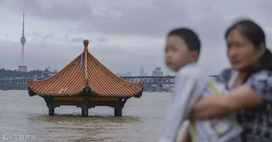
(Header image: A woman and a young boy stand by the Yangtze River, where a pavilion has been partially submerged by floodwater, Wuhan, Hubei province, July 4, 2016. Dongdong/VCG)