If you want to drive in Jilin Province, there are some little cities, towns and villages which are good to visit, like Meihekou 梅河口, Yanji 延吉, Hunchun 珲春,Ji'an 集安,Tonghua 通化,Linjiang 临江......
Today we will introduce Linjiang 临江 lín jiāng.
Linjiang city is located in the southeast of Jilin Province, 126°11 '~ 127°35' E, 41°27 '~ 42°4' N. It borders the Changbai Korean Autonomous County in the east, Badaogang District in the west, Jiangyuan County and Fusong County in the north, and the Democratic People's Republic of Korea across the river in the south. The border is 146 kilometers long.
Total population: 170,000 (2009).
Located in the hinterland of Changbai Mountain besides the Yalu River, it is surrounded by mountains on three sides, facing the river on one side. It has a temperate continental monsoon climate, with four distinct seasons. The annual average temperature is 24℃, and the annual precipitation is 750-1000 mm. The nearby Yunfeng reservoir was a joint-construction project built by China and the DPRK.
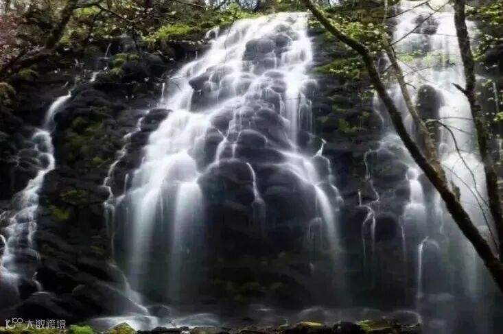
Scenic spots include the Huashan national forest park, Guandong “Hot Spring City”, the ancient ruins of the Ming Dynasty and other locations.
wàng tiān é
Lookout Swan Mountain, also known as the “15 Daogou”, is located in a massive caldera created by a huge central eruption and was created via overflow into a volcanic basaltic cone. Due to the volcanic activity in the valley, the landscape is very unique.
It offers a spectacular scenic view of the surrounding area, and most of the local geological attractions are located within about 13 km of it.
The mountain gets its namesake from the fact that from afar its shape looks like a swan with its head held high.


Lǎo tū dǐng zi mountain ⛰
283km from Changchun. Height: 1339 m. Located 28km from Linjiang city, you can see Changbai mountain's main peak from Laotudingzi mountain.
Road view
from Linjiang to Changbai mountain